Geology and Water Contamination
Horse Creek’s geology, especially its karst topography, appears dangerously incompatible with massive industrial development, specifically in regards to industrial wind construction requirements and conditions. Risks include:
- Aquifer and well water contamination via soil overburden infilling on shallow bedrock in a karst topography-rich environment.
- Sinkhole collapse at turbine bases via increased bedrock erosion and dissolution.
- Moderate regional seismic risk, according to the United States Geological Survey.
Geological Setting
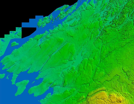
Photo: River RATs © All rights reserved
|
The main bedrock in the project area is a fine grained limestone pertaining to the Black River Group (BRG). The BRG resulted from the deposition of coastal lowland carbonate sediments during the Middle Ordovician, roughly 460 million years ago.
Structurally, Northern New York state and the southern portion of the Canadian province of Ontario are characterized by southeast-northwest trending fault systems resulting in negative flower structures. |
Locally, shallow bedrock depth and documented karst topography concern not only local residents familiar with the area, but also independent investigators commissioned by wind developers in 2007 and 2010.
Karst topography consists of limestone eroded by dissolution to create underground drainage systems, sinkholes and disappearing streams. Karst occurs where acidic water starts to break down the surface of bedrock near and beneath the surface. It may include sinkholes, vertical shafts and other features. Beneath the surface, complex underground drainage systems (such as aquifers) and extensive cave and cavern systems may also develop without warning below the surface.
Karst is an integral part of the geological and hydrological context of northern Jefferson County. The project area’s limestone is often exposed (outcrop) or extremely shallow, often with little to no soil overburden. Anyone who has visited the area will be familiar with the grey limestone outcrops that dot the landscape, as well as limestone "pavement" that is exposed or thinly covered with soil. Inland rivers, including those in the project vicinity, are known to disappear underground and appear again after great distances.
Significant Geological Risks Have Been Identified
A 2007 report prepared by Atlantic Testing Laboratories Limited for PPM Energy, the original developer of Horse Creek, clearly identifies karst topography and subsequent construction concerns. PPM Energy was acquired by an Iberdrola subsidiary in 2008.
Per the 2007 Atlantic Test Laboratories report,
“Due to the fine grained soil encountered in the test pits and high natural moisture content, it may be difficult to achieve the required unit weight during placement and compaction of the fine grained on-site material, requiring the use of imported fill. Additionally, due to the presence of shallow bedrock, sufficient quantities of on-site material may not be available for use as backfill"
This means that Horse Creek, in addition to pouring massive concrete foundations, likely requires significant amounts of imported fill to anchor the turbine bases. Practically, this means hundreds or thousands of extra dump truck trips, use of heavy equipment, dusty roads and potential environmental hazards including hydrocarbon environmental contamination.
As this karst environment has very little overburden, there are few filtering processes. With only rock, contamination can more easily reach the water supply.
This raises water quality questions for well and spring-water dependent residents who live in and around the project area. Will residents or livestock become sick if water supplies become contaminated from imported backfill that erodes into the groundwater?
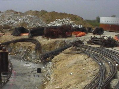
Wind Turbine base construction. Photo: National Wind Watch © All rights reserved
|
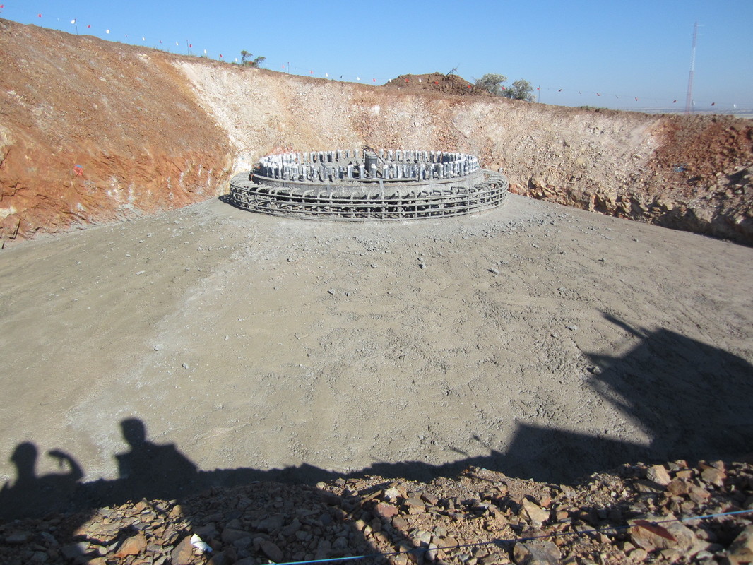
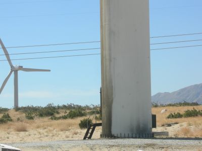
Completed wind turbine base. Photo via National Wind Watch. Photo: Francesco Miceli © All rights reserved
|
A later 2010 report prepared by Terracon Consultants, Inc. titled “Preliminary Karst Condition Assessment” was submitted to Iberdrola with the following objectives,
“…observe and document the ground surface and/or exposed bedrock conditions at and proximal to each wind turbine location and along the planned access drive routes for indications of karst conditions, review available historic documentation for indication of karst conditions, review available information regarding the subsurface conditions and site geology, and to provide our recommendations for remediation and/or recommendations for additional investigation.”
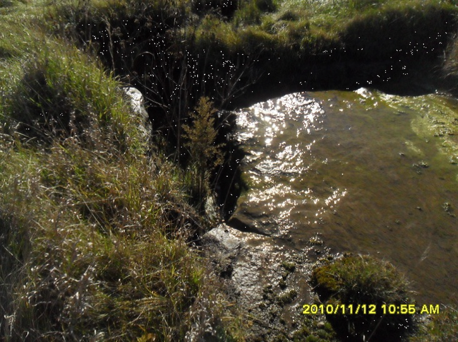
This report raises further concerns from other geologists and project stakeholders who have reviewed the project. The 2010 report continues,
"Of particular concern at the site are areas of "disappearing streams" noted at two locations during the site reconnaissance. These streams channel surface water from the surrounding farmland into the bedrock. These disappearing streams, or "drains", have the potential to focus a significant amount of water into the underlying bedrock, increasing the rate of erosion and dissolution of underlying bedrock. Drains were observed at the planned O&M Facility No. 1 and near wind turbine No. 54. Consideration should be given to move development away from these areas."
“…observe and document the ground surface and/or exposed bedrock conditions at and proximal to each wind turbine location and along the planned access drive routes for indications of karst conditions, review available historic documentation for indication of karst conditions, review available information regarding the subsurface conditions and site geology, and to provide our recommendations for remediation and/or recommendations for additional investigation.”
This report raises further concerns from other geologists and project stakeholders who have reviewed the project. The 2010 report continues,
"Of particular concern at the site are areas of "disappearing streams" noted at two locations during the site reconnaissance. These streams channel surface water from the surrounding farmland into the bedrock. These disappearing streams, or "drains", have the potential to focus a significant amount of water into the underlying bedrock, increasing the rate of erosion and dissolution of underlying bedrock. Drains were observed at the planned O&M Facility No. 1 and near wind turbine No. 54. Consideration should be given to move development away from these areas."
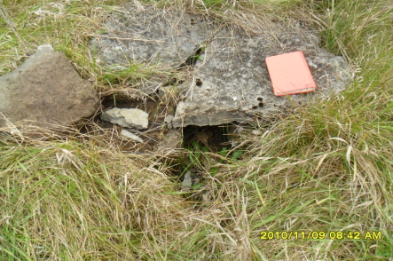
|
|
Photographs of concerning geological features per Terracon in their 2010 "Preliminary Karst Condition Assessment" to Iberdrola
This report reconfirms serious concerns about geological incompatibility. Once again, it is not impossible to imagine access roads, built on shallow or exposed karst limestone, along with any karst conditions in the immediate vicinity of the turbine bases, focusing soil and other contaminants into bedrock and the water system.
This 2010 field survey was limited in scope and detail and did not field-check each of the proposed turbine sites identified at that time. This study also did not fully investigate the entire impacted project area, including about 22% of the proposed access roads. Nevertheless, this survey identified many "sink holes" (some up to 10 feet in diameter) and other karst issues, such as highly fractured exposed bedrock and geological anomalies at over about 17% of the proposed turbine locations.
Given the significant conditions found in this "preliminary" assessment, Terracon recommended a much more expansive geophysical analysis of the proposed project site as follows,
"At this time, we recommend that a geophysical survey be completed to further evaluate the areas of concern (wind turbine Nos. 5, 6, 38, 41, 48, 49, 50, 54 and 58) identified during the site reconnaissance. However, because of the risk of additional karst features at other turbine locations that did not indicate surficial anomalies, consideration should be given to completing geophysical surveys at each turbine location. The geophysical survey should include electrical imaging (EI) to provide a cross-sectional image of the subsurface conditions to a depth of about 50 feet below existing grade. The EI survey is effective in identifying solution cavities or voids, which are not propagating to the ground surface. Following the EI survey, we recommend that soil borings and bedrock coring be completed to further define the subsurface conditions. The borings would be completed at locations that exhibited abnormal subsurface conditions, as determined by the EI survey. The purpose of the borings would be to further evaluate the subsurface conditions and categorize them as they relate to long-term risk for the proposed development."
It is very important to understand that the current Horse Creek project, compared to the 2010 study, covers an expanded and much larger geographic area (from 19 to 48 square miles) with an increased number of turbine sites (from 48 to up to 72). Obviously, with such an expanded project area, it is possible that the conditions and risks identified in 2010 will only be magnified.
There is also the possibility that with the increased project area and flexibility of Article 10 process allowing an increase in project size up to the point of final approval, Iberdrola could increase the number of turbines well above 72, exacerbating geophysical risks.
At this time, we are not aware of any such follow-up geophysical studies conducted by Iberdrola that addresses these significant concerns, despite their continued proceeding for Article 10 regulatory approval.
Explore Further
Geology Risk Summary
Given the shallow limestone bedrock, karst topography, and likely need for imported soil to secure massive turbine foundations, the risk of water contamination during construction and later operation could be tremendous.
It appears reasonable to expect groundwater to be affected during the concrete-pouring stage, an issue not explicitly addressed here. Without substantial overburden, there are few if any mechanisms to filter contaminants before entering the water table.
It appears reasonable to expect groundwater to be affected during the concrete-pouring stage, an issue not explicitly addressed here. Without substantial overburden, there are few if any mechanisms to filter contaminants before entering the water table.
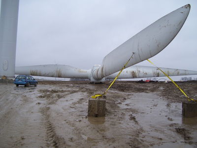
Photo: National Wind Watch © all rights reserved
|
Hydrocarbon contamination from gear/lubricant oil leaking from turbines. Photo: National Wind Watch © all rights reserved
|
Here is a recent video from very near Horse Creek demonstrating how the area's geology
transports water from ground level into the bedrock and water supply. Taken three days
after rain, the surface is completely dry, with fractures and karst features transporting
water into the bedrock at depth. Video: River Residents Against Turbines © all rights reserved
transports water from ground level into the bedrock and water supply. Taken three days
after rain, the surface is completely dry, with fractures and karst features transporting
water into the bedrock at depth. Video: River Residents Against Turbines © all rights reserved
There is also a risk of hidden sink holes, which could potentially cause a turbine to collapse if proper testing is not done prior to construction.
Again we ask: Could hidden sinkholes potentially collapse and cause a 500 or 600 foot turbine to crash to the ground?
Again we ask: Could hidden sinkholes potentially collapse and cause a 500 or 600 foot turbine to crash to the ground?
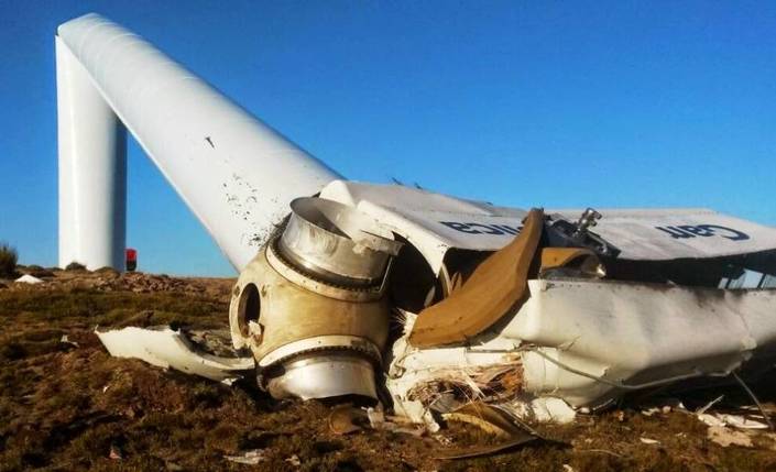
Photo: Mariano Sanjuan © All rights reserved
What about burying transmission lines? Does Iberdrola really intend to spend the time and money to excavate many miles of rock-cut channels through exposed limestone outcrops or shallow bedrock to bury transmission lines? Not doing so would mean constructing more overhead transmission lines that cause increased visual disturbance, more familiar on an industrial site than the current rural nature of the project area.
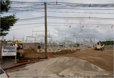
Wind turbine substation and transmission lines, Town of Clinton, NY. Photo via National Wind Watch by Christine Muschi/NYT
|
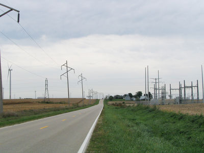
Photo: National Wind Watch © All rights reserved
|
Again we ask: Have any follow-up studies to address these serious concerns been completed in the past seven years to further identify and assess these risks?
Again we ask: If Iberdrola has completed these potentially project-altering studies, why have they not publicized them to the local community?
Again we ask: If Iberdrola has completed these potentially project-altering studies, why have they not publicized them to the local community?

Top Banner Photo: National Wind Watch © All rights reserved